


Highgate Voting District, Franklin County, Vermont
About
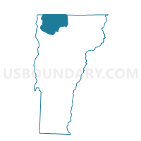
Outline

Summary
| Unique Area Identifier | 680798 |
| Name | Highgate Voting District |
| County | Franklin County |
| State | Vermont |
| Area (square miles) | 59.74 |
| Land Area (square miles) | 50.73 |
| Water Area (square miles) | 9.01 |
| % of Land Area | 84.92 |
| % of Water Area | 15.08 |
| Latitude of the Internal Point | 44.96319770 |
| Longtitude of the Internal Point | -73.05985680 |
Maps


Graphs
Select a template below for downloading or customizing gragh for Highgate Voting District, Franklin County, Vermont


Neighbors
Neighoring Voting District (by Name) Neighboring Voting District on the Map
- Franklin Voting District, Franklin County, VT
- Sheldon Voting District, Franklin County, VT
- Swanton Voting District, Franklin County, VT
Top 10 Neighboring County Subdivision (by Population) Neighboring County Subdivision on the Map
- Swanton town, Franklin County, VT (6,427)
- Highgate town, Franklin County, VT (3,535)
- Sheldon town, Franklin County, VT (2,190)
- Franklin town, Franklin County, VT (1,405)
Top 10 Neighboring Elementary School District (by Population) Neighboring Elementary School District on the Map
- Swanton School District, VT (6,427)
- Highgate School District, VT (3,535)
- Sheldon School District, VT (2,190)
- Franklin School District, VT (1,405)